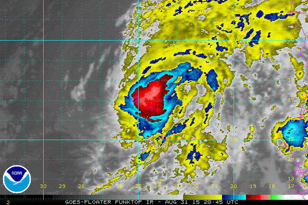

Hurricane Fred, with sustained winds reaching 80 mph, will pass over or near the northwestern Cape Verde Islands off the coast of Africa on Monday night (Aug. 31) and then move northwest into the central Atlantic Ocean. There, the storm is set to weaken rapidly over the next few days, according to the National Hurricane Center.
Fred, a compact hurricane, is forecast to weaken into a tropical storm by Tuesday afternoon, into a depression by Friday and become post-tropical on Saturday, forecasters said.
A hurricane warning is in effect for the islands, with Fred moving northwest at 12 mph, with a turn to the west northwest expected on Tuesday.
“Fred likely peaked in intensity this morning,” said Warning Coordination Meteorologist Daniel Brown in a 4 p.m. forecast discussion message. The storm’s eye has become open in its southern semicircle, though it remains embedded in high, cold cloud tops, he said.
“The environment ahead of Fred is expected to become increasingly hostile with marginal sea surface temperatures, increasing southwesterly shear, and less favorable thermodynamic conditions,” he said. “As a result, steady weakening is predicted.”
Fred’s small size will help wind shear tear it apart more quickly, and despite warmer sea surface temperatures along its forecast track on Friday and Saturday, the shear and dry mid-level air “are likely to cause Fred to become a remnant low by the end of the firecast period.”


